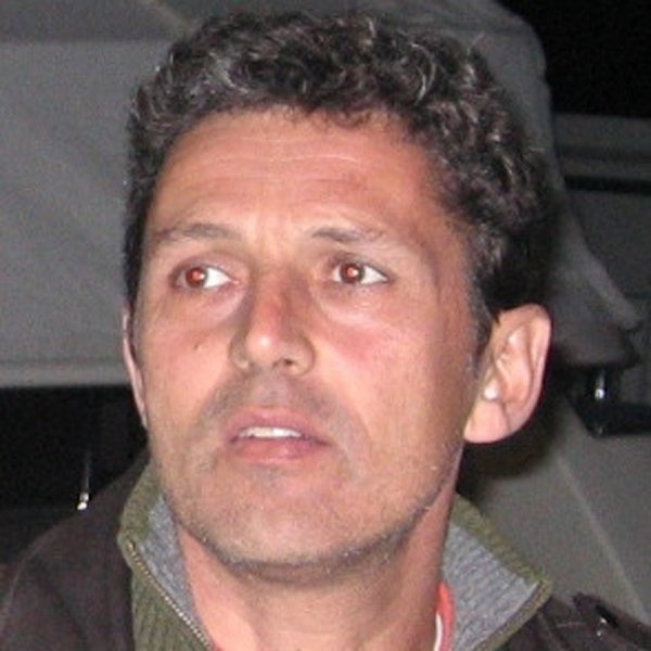
João Catalão
Profile
Research Group: RG1 – Climate variability processes and extremes
Position at IDL: Researcher
Job: Associate Professor
Email: jcfernandes@fc.ul.pt
Telephone Number: (351) 21-750-0833
Extension: 28147
Room: 8.1.47
Academic Degree and field of specialization:
Bachelor Mathematics, FCUL, 1984
Degree Geographical Engineering, FCUL, 1986
Doctoral Course at Complutense University, Spain, 1995
PhD Geographic Engineering, University of Lisbon, Portugal, 1999
Scientific Informations
ORCID: https://orcid.org/0000-0003-1028-4644
SCOPUS ID: https://www.scopus.com/authid/detail.uri?authorId=35727577400
Researcher ID: https://publons.com/researcher/1231771/joao-catalao/
Research Gate: https://www.cienciavitae.pt//5613-F2CA-0449
Scientific Interests
Main Interests:
He has developed his scientific activity in the field of Geodesy and Remote Sensing. His research is focused on measuring and monitoring the deformation of the Earth’s surface using multiple sensors (gravimeters, GNSS, InSAR). He has developed new approaches and algorithms for the integration of different geodetic measurements into a comprehensive 3D displacement model. At present, his primary interest involves meteorological applications of SAR and GNSS. This topic includes measuring and modeling precipitable water vapor and soil moisture estimated using different satellite based microwave sensors such as SAR and GNSS. Numerical modeling approaches include parameter estimation by inversion, SAR complex image processing, image classification and machine learning.
Top 10 Publications:
Marques, FO, Catalão, J, DeMets, C., Costa, ACG, Hildenbrand, A., 2013. GPS and tectonic evidence for a difuse plate boundary at the Azores triple Junction. Earth and Planetary Science Letters 381, 177-187, IF=4.349, Q1.
Catalão, J., G. Nico, R. Hanssen, C. Catita, 2011. Merging GPS and atmospherically corrected InSAR data to map 3D terrain displacement velocity. IEEE Transactions on Geoscience and Remote Sensing, Volume: 49, Issue: 6, Part: 2, 2354 – 2360, doi:10.1109/TGRS.2010.2091963, IF=3.467, Q1.
Benevides, P., Catalao, J., and Miranda, P. M. A.: On the inclusion of GPS precipitable water vapour in the nowcasting of rainfall, Nat. Hazards Earth Syst. Sci., 15, 2605-2616, doi:10.5194/nhess-15-2605-2015, 2015.
Nico, R. Tomé, J. Catalão, P.M.A. Miranda, 2011. On the use of the WRF model to mitigate tropospheric phase delay effects in SAR interferograms. IEEE Transactions on Geoscience and Remote Sensing, Vol. 49, Issue 12, 4970 – 4976, doi:10.1109/TGRS.2011.2157511, IF=3.467, Q1.
Oliveira, S. C., J. L. Zêzere, J. Catalão, G. Nico, 2014. The contribution of PSInSAR interferometry to landslide hazard in weak rock-dominated areas. Landslides, DOI 10.1007/s10346-014-0522-9.
Mateus, Pedro; Miranda, Pedro M. A.; Nico, Giovanni; Catalão, J., Pinto, P Tome, R, 2018. Assimilating InSAR Maps of Water Vapor to Improve Heavy Rainfall Forecasts: A Case Study With Two Successive Storms. Journal of Geophysical Research-Atmospheres, Vol 123, Issue: 7, pp: 3341-3355, APR 16 2018, DOI: 10.1002/2017JD027472
Catalao, J.; Raju, D.; Nico, G. Insar Maps of Land Subsidence and Sea Level Scenarios to Quantify the Flood Inundation Risk in Coastal Cities: The Case of Singapore. Remote Sens. 2020, 12, 296.
Catalão, J., Nico, G., 2017. Multitemporal backscattering logistic analysis for intertidal bathymetry. IEEE Transactions on Geoscience and Remote Sensing, 10.1109/TGRS.2016.2619067
Projects (10 most relevant):
2017/20 NIPOGES – Estado atual das populações de amêijoa-japonesa da Ria de Aveiro, lagoa de Óbidos e estuários do Tejo e Sado – bases científicas para uma gestão sustentável do recurso (MAR-01.03.02-FEAMP-0013). Financiado pelo Programa Mar 2020, – financiamento elegível (global FCUL): 581 810,00 €, nº doutorados na equipa: 8, duração total (meses): 36, datas início / fim: Dezembro de 2017 – Novembro de 2020
2018/20 GeoSuber – Monitorização do Montado, Financiado por PDR2020 – Grupos operacionais, PDR2020-101-031259, Coordenado por UNAC – UNIÃO DA FLORESTA MEDITERRÂNICA, valor 400 keuros, 1-jan-2018 a 31-dez-2020.
2018/20 CONTROL, CONsTRaining land-atmosphere exchanges using earth Observations, PTDC/CTA-MET/28946/2017, Coordenado por Emanuel Dutra, 239.381,66 euros, 1-10-2018 a 30-9-2021.
2016/18 Tracking climate change in drylands based on ecological indicators. Projecto FCT2015, PTDC/AAG-GLO/0045/2014, Coordenado por Cristina Branquinho. Financiamento 182640 euro, 1-6-2016 a 30-11-2019.
2016/18 MEGAHazards 2. Large-scale mass-wasting events in the geological evolution of the Azores islands: location, frequency, mechanisms and consequences. Projeto FCT 2015, PTDC/GEO-GEO/0946/2014, Coordenado por Fernando Ornelas. Financiamento 200k, 1-6-2016 a 30-10-2019
2016/18 FOGO, Fogo Island volcano: multi-disciplinary Research on 2014 Eruption. Projecto FCT PTDC/GEOGEO/1123/2014. Coordenado por Rui Fernandes. Financiamento total 200k, financiamento próprio 8k, 1-7-2016 a 31-3-2020.
2014/15 SOPHIA, Conhecimento para a gestão do ambiente marinho. Projecto EEA Grants coordenado pela DGRM e participado pela FCUL num total de 400000 euros (FCUL: 205k euros). Coordenador do módulo de formação: Deteção Remota – Aplicação de imagens de Radar de Abertura Sintética.
2015/16 Land cover monitoring for water resources management in Angola. Spot-Take5 project. Principal investigator. Projecto financiado pela SPOT e ESA para fornecimento de imagens SPOT na sua fase Take5.
2015/16 Snow water content retrieval from polarimetric SAR data using different frequency bands. ESA-Category-1 Proposal 29070 (C1F.29070). Projecto participado pela ESA com 170 imagens do satélite ENVISAT. Investigador principal.
2015/16 Land cover monitoring for water resources management in Angola. Alcantara Study Reference No.: Ref: 14-‐P13. Study Type: Pilot Study Contract Number: AO-‐1-‐7864/14/F/MOS. Projecto coordenado pelo Prof. Marco Painho, ISEGI. Valor contrato 100 000 euros. Responsável pela componente SAR do projecto.
2013/15 Permantar and Climate Change in the Antarctic Peninsula, PERMANTAR-3. PTDC/AAG-GLO/3908/2012. Contribuição na componente Detecção Remota (InSAR deformation). Valor do contrato 199434 euros.

